Sunday, December 19, 2010

Hello From Yuma, AZ - 12/19/2010


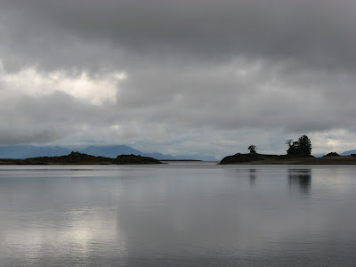
Typical Sunset In Yuma
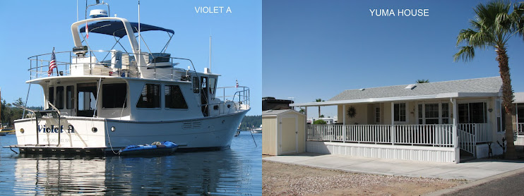
We haven’t updated our blog in quite some time so to those who don’t know, we left our home in Port Orchard around the end of October and headed south on our annual trek to our little home in Yuma. Since arriving, we have settled in with Karyl working 3 days in the park cafĂ© and me (Ron) doing mostly nothing. I was playing a lot of Ping-Pong but about a month ago I badly hurt my knee going after a side shot. After going to the emergency room where they diagnosed it as a sprain I have been trying to strengthen the knee by lots of walking and bicycling but I think something bad has happened in the knee as I have a funny pain with certain positions. I can’t get it checked out until we return to Port Orchard because of my insurance limitations.

We took a short 4 day trip to some sights in SE Arizona, south of Tucson. We left Wednesday morning in our little Winnebago View motorhome and drove about 290 miles to Kartchner Caves state park and camped in the adjacent campground. That late afternoon we took the last guided tour of the day to go into the caves. There where only 2 others with us so we had the guide almost to ourselves when normally there are up to 20 people on a tour. These caves where first discovered in 1974 and became part of the Arizona State Park system in the late 1990’s. They have done a great job in developing the site and protecting the caves. We had to go through 3 airlocks before we entered the caves. This maintains a constant temperature of 70 degrees and a humidity in the 90’s. For further information click on: http://www.azstateparks.com/Parks/KACA/index.html

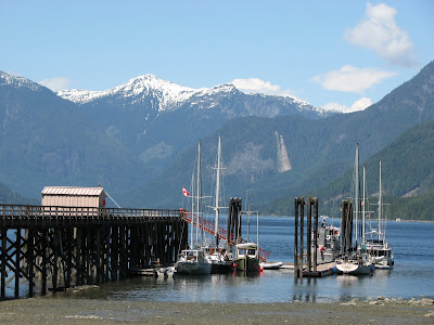
Kartchner Parks Campground

The next day we headed to the town of Tombstone, about 20 miles further south and parked in a campground across the street from the famous OK Corral. The town is very commercialized but still interesting with lots of gunfight shows and museums. We went to one gunfight show (disappointing), a mine tour, and the courthouse museum which was great. It was fun walking around the town and imagining how it was back in the 1880’s. That night we had our first rain since we arrived in Arizona over a month and a half ago. It sure smelled good to have moisture in the air but the next day was dry again.


We debated the next morning to stay another day in Tombstone or head further south to the town of Bisbee. We decided to make a day trip to Bisbee and after checking out the town head back to the Kartchner Caves campground to spend the night before heading back home to Yuma on Saturday.

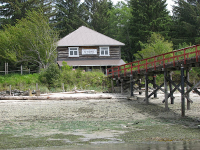
Downtown Tombstone

Bisbee is another town that developed because of mining. Whereas Tombstone was developed because of silver mining, Bisbee’s mining was copper and it is said that more copper was pulled out of the area mines than any other mine in the US. Now the economy is based on tourism with many artsy-fartsy shops populated by 60’s hippies. When we arrived Friday morning, Karyl and I parted ways. She went to check out the shops and I went to the local museum. We got back together around lunch time and went to one of the local places that was recommended for its soup and sandwich fare. Afterwards, we walked around the town checking out the architecture. In this part of Arizona, it is very hilly, even mountainous and Bisbee is built on these hills. Some of the houses are way up and it looked like the only way to get to the house was up a huge flight of stairs, maybe 2 or 3 hundred feet up. The town claims it has the best climate in the country. Click on http://www.discoverbisbee.com/ for further information. That afternoon we drove back to Kartchner Caves campground for the night and Saturday morning we headed back to Yuma. All in all, a fun trip.

Downtown Bisbee, AZ


MERRY CHRISTMAS AND HAPPY NEW YEAR

Wednesday, August 25, 2010

We Are Back Home

August 25, 2010

We made it back to the home dock today and after spending 2 hours unloading the boat we are in the house. No movement, no view and the dogs, Max and Maddie, are happy. After leaving Ganges last Sunday we headed to Roche Harbor to clear customs into the USA again with our friends, Larry and Marci following us in their boat. The customs officer came aboard to check us out and ended up taking the tomatoes that Karyl bought the previous day in Ganges because they where not grown in the US or Canada. Oh well, that’s better than what happen a few years ago during the mad cow scare when customs took a couple of very nice New York steaks when we entered the US.

After getting cleared we headed to Garrison Bay on the opposite side of San Juan Island. This is one of our favorite anchorages and has a small dock to land the dinghy so it is easy to get off the boat. Larry tied his boat to ours and we went ashore to explore the park where they have restored some of the buildings from when the British had a garrison here before the present US/Canadian border was established.

The next day we headed to Hunter Bay on Lopez Island and anchored for the night. This placed us fairly close to Deception Pass where we have to time our passage for slack current. We had a peaceful night along with about 30 other boats but the bay is huge so we never felt crowded.

We made it though Deception Pass on the 24th and continued on to Oak Harbor. Larry and Marci said goodbye here and they continued on to Everett where they keep their boat. When we tied up in the Oak Harbor Marina we called brother John and he came down to visit. We went over to his house and had a great fish and chips dinner with his wife and daughter Rena. We made the decision to continue on home the next day instead of staying around another day as originally planned because we felt we needed more time to unload the boat and clean it up before Uncle Perry and Bobbi come to visit us after their cruise ship trip to Alaska. They are arriving in Seattle on the 29th and will be staying with us for a few days. Anyway, we made the trip from Oak Harbor to Port Orchard today in about 7 hours and 54 miles. It was a beautiful day with calm seas and no wind and for most of the trip we had a wonderful current that gave us a knot of boast. After arriving in Port Orchard the work began. We had to unload clothes, food, laundry and other misc. stuff. As I write this, we got most of the stuff off which filled the back of my pickup to the top - that was all we could take today. So things are somewhat back to normal but there is still a lot of work to do getting the boat empty and cleaned up after our trip of 3 months and 2060 miles.

Thanks everybody for keeping track of us and having an interest in our trip to Alaska.

Friday, August 20, 2010

From Ganges, BC

August 20, 2010

We dropped off my cousin Bob and his wife Karen in Nanaimo and joined up with our friends, Larry and Marci. We had a great time with Bob and Karen and the boat seems empty with them gone. Larry and Marci came up to Nanaimo in their 30 foot Bayliner Express Cruiser from Everett to cruise home with us. They travel at 20 knots and since we can only go 7 ½ knots, Larry was willing to slow down some so we could stay together on our passages.

We left Nanaimo at 11:30 so we could catch the slack current through Dodd Narrows, however, we were a little early and we had a couple of knots of current against us as we went through the narrowest part. There were quite a few boats waiting to traverse the rapids as everyone is now heading south towards home. We headed to one of BC’s Provincial Parks, Princess Cove, which is located on Wallace Island. We have never been there, but heard many good reports so we thought we would gave it a try. When we arrived it was blowing over 15 knots right down the cove. In most parts of this cove it is required to anchor and then stern tie to shore so the boat will not swing on the anchor so it allows for more boats. The problem was that the wind was trying to force the boat 90 degrees to the anchor. I got the line to shore OK, but it was almost impossible to pull the boat around so it would be perpendicular to the shore and in line with the anchor. Another boater in the cove noticed my problem and used his inflatable dinghy to push my boat in line with the anchor while I tightened the shore tie line. When this was done, Larry brought his boat along side and we rafted together so we could socialize. This caused even more strain on the anchor and shore tie. I took my dinghy and brought his anchor out off the side of his boat to drop his anchor and line. This helped keep our boats from being pushed sideways to the wind which made us pretty secure. This whole procedure took about 2 hours of hard work and we where all exhausted. About an hour later, a 50 foot sailboat came in and dropped his anchor very close to where we were. After the wind died down, we retied our stern line further downstream to keep us from drifting if the wind or currents changed over night. As it turned out, that was a good thing as the wind changed direction and we drifted even closer to them the next morning. It never hurts to have an extra line out in crowded anchorages even when stern tying.

The next day we headed again to Ganges on Salt Spring Island so could attend the Saturday market. We stopped here last year with Larry and Marci and really enjoy their amenities. We wanted to get there early as we felt it would be easier to find dock space. This is a favorite stop for boaters, especially in the summer. Larry went first and found a spot on the dock and then found another boater who was about to leave. He talked them into waiting until we arrived so we could have his space. Amazingly, another friend of mind, Robb, was already at the dock and was there to help us tie up. It was amazing because last year when we came to Ganges, Robb was also at the dock to help us and that was the last time we saw him. What a shock! Robb, Larry, and Marci joined us for a great steak dinner on our boat that evening and everyone told sea stories. It was a fun evening.

Our plan is to leave Ganges tomorrow and head back to the USA to clear customs and perhaps spend a few days in the San Juan Islands before heading to Whidbey Island to see brother, John and his wife Joanne and then head home on the 26th.

Wednesday, August 18, 2010

Hello From Nanaimo

August 18, 2010

After leaving Sullivan Bay Marina, we headed to Echo Bay Marina for another day of fun. While there we took a hike to Billy Procter’s Museum on the other side of land. This was a pretty strenuous hike up and down steep hills, and in a couple of spots, ropes where provided to pull yourself up the hill. Billy Procter has lived in the area all his life and has made it a point to collect “stuff” where ever he finds it. He admits his museum is full of junk, but it was interesting. After the hike, the marina put on a pig roast which we took advantage of and there was entertainment put on by a group of musicians who are traveling around the area and getting, I assume, free moorage at the different marinas. The weather has finally changed for the better with almost hot clear skies and calm winds.

BILLY PROCTER'S MUSEUM

The next day, we headed to Lagoon Cove Marina which we stopped at on the way north. We took another hike across the land to “The Blow Hole.” This hike wasn’t as hard on us old folk so we took the dogs along. That evening we attended the happy hour and later were again entertained by the traveling musicians around a camp fire and roasted marshmallows. Lots of fun!

Now it was time to seriously start heading south. The next morning it was down Johnstone Strait and it was doing its typical thing of giving us strong winds, but this time they where behind us so we made great progress for the 10 to 12 miles we where in it. We stopped in Forward Harbour and anchored among 13 to 14 other boats. The next morning we went through Whirlpool rapids and Green Point rapids and stopped in Shoal Bay. We usually try to tie up to their dock, but this time the dock was full so we had to anchor for the night. The next day it was though another set of rapids, Dent and Gillard. With all these 4 rapids, it is best to time your transit for slack current or close to it. After we got through the rapids, we headed to Desolation Sound and anchored in Squirrel Cove for the night. We counted about 60 boats anchored here before the day was over. The further south we go the more crowded it gets.

The next day we headed to Refuge Cove for water and doing laundry. We stayed the night on the dock and the next morning we went to the heart of Desolation Sound and anchored in Prideaux Haven and also tied the stern to shore. This is necessary to make room for more boats as it can be quite crowded here. It had been rumored that Oprah Winfrey had been here the previous day and had been helicoptered to a large yacht for a few days. From Prideaux Haven, we headed further south to anchor in Ballet Bay on Nelson Island in the Pender Harbour area and then on to Smuggler’s Cove where we staged ourselves for the trip across Georgia Strait and on to Nanaimo. Bob & Karen had a flight scheduled on Kenmore Air out of Nanaimo for the 17th which would take them back to Seattle and on to their home in Pensacola Beach. The weather is still hot, maybe too hot for some of us, but a nice break from the constant overcast skies we have seen for the better part of this trip.


SCENERY SHOT IN DESOLATION SOUND

ANCHORED IN SMUGGLER'S COVE

SUNSET IN SMUGGLERS COVE

The crossing across Georgia Strait was uneventful with fairly calm seas and we arrived at the Nanaimo Yacht Club and tied up with the help of a couple of fellow Port Orchard Yacht Club members who helped us find a place on the dock. The next day we got Bob and Karen off on their float plane flight to Seattle and then spent the afternoon and evening with our yacht club friends.

Today is the first time I’ve had the time to get this blog updated. We are leaving late because we have another rapid to go though called Dodd Narrows. Our friends Larry and Marci have taken their boat up to Nanaimo and we will cruise together until we get home. The weather is changing and the wind is coming from the south. This will bring more clouds and lower temperatures.


Friday, August 6, 2010

Sullivan Bay, BC

This is a picture of our anchorage in Millbrook Cove the day before crossing Queen Charlotte Sound.

MILLBROOK COVE

This is the plane landing at Port McNeill yesterday that had cousin Bob and his wife, Karen aboard coming from Seattle.


KENMORE PLANE LANDING AT PORT McNEILL

August 8, 2010

We left Port McNeill this morning at 7:00 AM to try and avoid some adverse current on our way to Sullivan Bay Marina up in the northern reaches of the Broughtons. As we crossed Queen Charlotte Strait, the fog closed in on us and we had maybe a quarter of a mile of visibility. As we got closer to Sullivan Bay, the fog lightened up to just an overcast sky. We tied up to the dock around 11:00 AM


Sullivan Bay Marina is totally surrounded by water and is only accessible by boat or float plane. There is only one ramp to land and that is to the fuel tanks and is closed to the public. They get their electricity from a diesel generator that runs 24 x 7 during the summer season. It is owned by a consortium of home owners who live here during the season and has a restaurant, a general store, sells fuel to the visiting boaters, and has regular float plane service to the outside world. Oh yes, free internet! I was here about 11 years ago and found most of the floating homes were run down, but look at it now. See pictures below.


SULLIVAN BAY FLOATING HOME - NOTE THE HELICOPTER


Thursday, August 5, 2010

Port McNeill Again

August 05, 2010

We made it around Cape Caution and are now in Port McNeill waiting for my cousin Bob and his wife Karen who are flying in from Pensacola, Florida having arrived in Seattle last night. They fly to Port McNeill on a Kenmore Air float plane. They will accompany us to Nanaimo, BC for the next 12 days.

We left Shearwater on July 30th and went all the way to Millbrook Cove in Smith Sound, a distance of 63 nautical miles. This is the first time we have tried this anchorage and we entered it in a rather heavy fog. In the past we have stopped in Fury Cove to await the next day to cross around Cape Caution, the open ocean passage to the north end of Vancouver Island. Millbrook Cove is another 12 miles further along and cuts the open ocean passage in half so during that 12 miles, a good part of it was in the swells and lumpy seas we always seem to experience in this area. When we finally arrived at Millbrook Cove, there where 6 other boats at anchor but the bay is fairly good size so we easily found a spot for our anchor.

The next morning at 5:00 AM we raised the anchor and started out to round Cape Caution. Again, the seas where lumpy and we had a 2 to 3 foot swell right on the beam. Lots of rocking and rolling and as I’ve said before, these open ocean passages are just something to be endured. Luckily, the wind was light so we didn’t have to contend with wind waves on top of the swell. The fog was very heavy, but with the radar and chart plotter we knew were we were and who was around us at all times. After 41 miles, we arrived in Blunden Harbour where we dropped the anchor.

Blunden Harbour was once the site of a thriving Indian village and there is an extensive midden by a deteriorating long house that has long since fallen down. The vegetation has pretty much taken over the whole site now, but walking the beach you can still find pieces of pottery, glass and metal left over from the old days. We spent 2 days here before taking off for Port McNeill where we are now.

Our plan from here is to spend time showing Bob and Karen the Broughtons and then moving south to Desolation Sound before going to Nanaimo where they are going to catch a plane back home. We have to be in Nanaimo on the 17th for them to make the flight on Kenmore Air.

Friday, July 30, 2010

Hello From Shearwater Again

July 30, 2010
After an extremely rough night at the dock in Prince Rupert, we took off at 5 A.M. to catch the tide and favorable winds to start the trip down Grenville Channel. The fishing fleet just happened to come in our last night on the dock and the waves seemed to never stop. At one point, we even jumped out of bed because we thought one of the large seiners was going to ram us! The boat rocked so hard, we were afraid it would break our dock lines! We got underway and the trip around the Lawyer Islands (we don’t want to know how they got that name!), was pretty calm. On our way north when we went around these islands, it was rough and we had to take an alternate route to try to get to Prince Rupert. My prayers were answered. We went to Lowe Inlet to try to get as far down Grenville Channel as possible, even though we told ourselves we would not stop there again after spending our last two stays there losing a whole night’s sleep on anchor watch. The third time must have been the charm because we got a good spot and the night was uneventful. We were again up early to catch the favorable tide and seas to finish Grenville Channel and head to our next stop at Khutze Inlet. The wind started to pick up as we rounded Hartley Bay and headed to McKay Reach. Wright Sound and Whale Channel can get choppy as the water swells in from Hecate Strait. We got around the point and into Fraser Reach, passing an 80 foot yacht. We commented on the boat and headed south. About an hour later, we heard that boat radio a distress signal to the coast guard that they were having engine trouble and were dead in the water in McKay Reach! They commented that it might be a fuel problem as both engines quit running. We talked about going back to help, but heard several other boats offer to help on the radio. Since we are only 37 feet, we would have had a hard time helping an 80 foot yacht, plus we were at least an hour away, so we were glad that there were others closer. Boaters will usually try to help each other, because you never know when it will be your turn to need help. That area is near where the Canadian ferry ran aground and sank a few years ago. Rumor has it that the helmsman and a crew mate were in the pilot house and failed to notice that the trees on the island were getting awfully close! There are several stories as to why they did not notice, but we will leave it to the story tellers! The Indians at Hartley Bay were the only people that heard the mayday that early in the morning and headed out with all their skiffs to try to help. All the people on board were saved except for two people that were never found when the ferry sank. We plan to stop in Hartley Bay on our next trip north.

A TYPICAL DAY ON THE WATER IN NORTHERN BC

We continued south to Khutze Inlet. We have always been lucky and managed to get the best spot behind the spit near the entrance and we did this time too. We promised ourselves that we would take the 5 mile trip to the end of Khutze Inlet to see if it is as nice as they say. When we are just passing through, we are reluctant to motor the additional 10 miles (5 miles in – 5 miles out) just to see what’s at the head. For now, we will trust the glowing reports in the cruising guide and save that for when we don’t get the spot behind the spit. There ended up being 4 other boats anchored around us by the end of the day and it was pretty bouncy. The wind was blowing which can make a pretty good chop in this anchorage. Up early again, we headed out of Khutze and were dismayed to see there was a pretty good south wind and lots of waves when we got into the channel. UGH! Being anxious to get out of the area, we toughed it out and found that it got better the further we went (yeah!). We stayed in Tolmie Channel toward Klemtu to get out of some of the chop. We have decided that the Canadian and Alaskan currents and tides that are listed in their tables are no where close to the actual tides and currents. No matter how we tried to plan our trip to catch favorable currents, we ended up fighting them most of the time. On our way into Lowe Inlet, we had 4 knots of current against us and the tables said we should still have them in our favor. When you go only 7-1/2 knots, 4 knots against you does not leave much headway. This was the case for most of our trip down to Oliver Inlet. We stayed there instead of Rescue Bay as it was closer to Seaforth Channel. It can get a little rough in Seaforth and we planned to get up early and hoped to have favorable wind and waves to get to Shearwater. We were smart and called a day ahead to get a spot n the dock as they were turning boats away shortly after we docked. We got the laundry done and some much need provisions for our next trek south around Cape Caution and on to Port McNeill in the next few days.

We plan to be in Port McNeill by August 4th as Ron’s cousin, Bob and his wife Karen, will join us on the 5th to head toward Nanaimo. They are predicting favorable winds through Sunday, so we will join the herd of boats heading south tomorrow.

Monday, July 26, 2010

Back To Prince Rupert

July 26, 2010

We made it back to Prince Rupert and we did it yesterday. We went the whole way from Ketchikan to Prince Rupert in one long 12 hour day covering about 85 nautical miles. That is a long distance when only doing 7 knots believe me! We left Ketchikan at 5:15 in the morning with a light wind out of the north. This put the wind behind us so we didn’t have to climb over the waves as would be the case if the wind was southerly. The sea conditions where mostly very tolerable except for a few places in Dixon entrance which is open ocean. I’d say it never got over 3 feet seas, but when we where exposed to the open ocean the seas were almost on the beam which causes the boat to roll and is very uncomfortable. Karyl pretty much hand steered the boat the entire way because she says it takes her mind off the sea conditions. She hand steered because the autopilot would veer around to much with these sea conditions and hand steering keeps the boat on course better.

We had planned to stop in Foggy Bay, about 35 miles from Ketchikan, but when we got close to this point it was clear that the conditions in Dixon Entrance where very favorable to continue. Our next planned stop was Dundas Island, but when we got close to it, Karyl said lets just go all the way to Prince Rupert. That was another 35 mile distance and another 5 hours. Keep in mind she is still hand steering the boat. I was concerned she was too tired, but she insisted, so on we went.

MOORED IN PRINCE RUPERT
When we arrived in the harbor, we called the Prince Rupert Yacht Club to see if they had a place to park the boat. This was nearing 5:00 PM and I fully expected to hear “Sorry, but no cigar.” As luck would have it, they just got a cancellation and let us tie up to their dock and here we are. Unfortunately, this area of their dock is exposed to the open water and the wind is keeping us pinned to the dock. In addition to that, a lot of boats going by do not observe the "no wake regulation," so we are bouncing around worse than any anchorage we have had this trip. It does quiet down at night except for a few boats speeding by in the dark of the night, so it is tolerable. On the plus side, we are having a nice sunny day which is really rare in this neck of the woods.
NICE EAGLE SHOT

Tomorrow we will continue our way south. Probably stopping in Baker Inlet for the night and hope to be in Shearwater on the 31st. Shearwater will be the first place we will have any facilities for laundry, water and internet. So, see ya then.

Saturday, July 24, 2010

Still In Ketchikan

July 24, 2010

HARD DAY AT THE OFFICE

We are still in Ketchikan. Our last post on the blog said we where going to head south Friday towards Prince Rupert but when we woke up that morning the wind was really blowing out of the south in the thirties and forties and even the fishing boats where staying put. We heard that a cruise ship had to bypass its normal stop in Ketchikan because of the high winds and the cruise ships that did stop required tugboat assistence to get to the dock. It was just a crappy day until towards evening so we stayed. The weather report also said the winds where going to continue out of the south today but by Sunday the winds will veer to the north. North winds are good because if we have to have wind we want it to come behind us instead of on the bow which can make for an uncomfortable ride pounding into that stuff.

Friday night, the Ketchikan Yacht Club had a fish fry for its members and guests so we attended that. All the halibut, salmon and salmon cakes you could eat. YUM! Also the weather improved greatly so we had fun listening to sea stories with the natives.

Tomorrow morning we are leaving and heading to Foggy Bay or if the conditions are right, we will go further either to Dundras Island or maybe all the way into Prince Rupert but that is unlikely as it would be a 12 hour day. In any case I think our time is limited in Alaska.

If we get dock space at the Prince Rupert Yacht Club, I will let you know if we made it. They have a good internet hook up so I can update the blog. Otherwise, who knows when I will get internet access after that, probably Shearwater which is at least a week away.

Thursday, July 22, 2010

Goodbye Ketchikan

July 22, 2010

Hello from Ketchikan again. We arrived here yesterday after leaving Thorne Bay with a non eventful passage in moderate seas and light wind. The sunshine is gone now with the days having a heavy overcast and intermittent rain. This is typical SE Alaska weather but we did have 3 days that had a lot of sunshine especially the day we where in Wrangell.

ICEBURG IN CHANNEL OUTSIDE OF PETERSBURG

LEAVING PETERSBURG WITH FISHING FLEET


SCENERY SHOT IN WRANGELL NARROWS

After leaving Wrangell, we where going to Thorne Bay but as the voyage progress, we decided that it was too far to go so we stopped in a bay called Santa Anna Inlet and dropped the anchor. While there, another boat came in that happened to be a fellow yacht club member who are also cruising Alaska. Small world, eh? They came over in their dinghy to say hello and give us an update on their travels.


THORNE BAY

From Santa Anna we traveled across Clarence Strait to Thorne Bay. The town itself doesn’t have anything that makes it special but we enjoy the place anyway. There is a shop that does laser woodwork and we always buy some piece of art every time we are there. The boat has a couple of pieces hanging on the walls. There was a fisherman on the dock cleaning his catch of the day and we got to talking to him which was very interesting but he gave us a filet of halibut that we enjoyed that evening. Thorne Bay was once the largest logging operation on the west coast but that has all gone away. One interesting thing was when we where at the dock, right in front of us was a 50 foot boat that was a traveling veterinarian. He would go to all the out of way places around there and offer his services. There was a steady stream of people bringing their dogs and cats to him and he even conducted an operation neutering a 6 month old dog.

THE VETERINARIAN BOAT

We left Thorne Bay early the next morning and headed into Ketchikan. When we arrived we topped off the fuel tanks taking on about 120 gallons and than got a slip at the Ketchikan Yacht Club like we did on the way up about 2 weeks ago. Tomorrow morning we plan to head out of here and spend the night at Foggy Bay. Foggy Bay is the normal staging area for boats about to cross Dixon Entrance and is about half way between Ketchikan and Prince Rupert in Canada. Boats stay there waiting for decent weather to make this open ocean passage. So far the weather report hasn’t been encouraging with predictions of high winds and seas but we are still hopeful. If you don’t hear from us in a month or so, it means we have to stay in Alaska until next summer. (Just kidding.) But it can take a week or two before a decent weather pattern set in again. Hope that is not the case this time.


Sunday, July 18, 2010

Sunshine In Wrangell

July 18, 2010


I just had to tell everyone that we are having a totally gorgeous day in Wrangell, Alaska. It must be in the mid seventies and hardly a cloud in the sky. Sorry, I don't have any pictures to share. I will be losing my internet connection in a few minutes so I wanted to get this out. I don't think we have seen a day like this since we left Yuma. Alaska sure is pretty when you can see it. We took the dogs out for a walk and went about 3 miles round trip to the new Wrangell marina on the other side of town. Wore everyone out, especially the dogs.

We are fully commited to heading south now. We should be in Ketchikan day after tomorrow where we will wait for a decent weather window to cross Dixon Entrance and into Canada. We should have an internet connection while in Ketchikan.

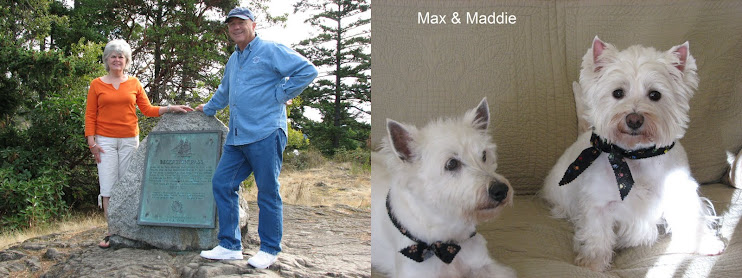
Ron, Karyl, Max & Maddie

Saturday, July 17, 2010

Petersburg, Alaska

July 17, 2010

We left Ketchikan early Wednesday morning heading to Meyers Chuck, a little settlement about 35 miles north. On the way we had some pretty rough water where Behm Canal meets Clarence Strait, but after we completed crossing Behm, the water smoothed out. We entered Meyers Chuck early that afternoon and tied up to the free dock. Meyers Chuck is one of those small settlements where less than 10 people live here year round, but in the summer the population triples or more. We noticed a few more houses had been built since we where here 3 years ago. The dock is getting worn out, however, and looked to be deeper in the water.

MEYERS CHUCK POST OFFICE

The next day we again left early in the morning (we try to leave early to avoid the high winds that usually occur in the afternoon) and headed to Wrangell via Zimovia Strait and after 50 some miles, arrived at the public dock. We walked around the town and found a place that sells the ‘Exploring SE Alaska’ cruising guide that I forgot to bring. A little late now, but it is good to have it for reference just in case. A $75 dollar mistake!


WRANGELL WATERFRONT

On Friday, we headed for Petersburg which may be our last stop north before we head back. We didn’t leave until almost 1:00 PM because we had to time the current going though Wrangell Narrows which is a passage that has something like 60 navigation aids to keep traffic off the rocks. There are a number of dredged channels and lots of twists and turns that keeps the skipper very vigilant. This passage is used by all types of marine traffic including the 200+ foot Alaska ferries. In the past, I had to avoid one of these behemoths coming in the opposite direction, but this time we only encountered small fishing boats. If not timed right, the current can be up to 7 knots and if going against your direction, will stop your forward progress especially for a slow boat like ours.

We arrived in Petersburg around 6:30 PM yesterday and tied up in the public marina. We haven’t been here for 3 years and it appears the town is having a rough time. This is a working harbor with lots of fishing boats, but the docks are in a bad state of repair and a lot of boats look like they haven’t been seen by the owner in a number of years. The weather has been cloudy and cool but no rain. Where is summer?


PETERSBURG HARBOR


PETERSBURG FISHERMANS MEMORIAL

There are several LARGE sea lions that fish in the harbor. It is amazing to see them swimming and eating right behind the fish boats. They have learned where the fish cleaning stations are and wait for scraps that get tossed in the water. The fishermen are complaining that they have trouble finding crabs and there are many bays that no longer have fish and prawns due to the increase in sea lions, otters and whales.

After much debate, we have decided to make this our last stop north and will start to head back home tomorrow. Mostly, we will retrace our route back with maybe a few different places on the way. The boats log says we have traveled 1108 nautical miles since starting the trip on May 31st. It sure doesn't seem that far.


Tuesday, July 13, 2010

Hello From Ketchikan

July 13, 2010

Well here we are in Ketchikan, Alaska. FINALLY! We had some good and bad during the trip here from Prince Rupert. When we left Prince Rupert we had planned on a intermediate stop at Dundras Island and leave early (oh dark thirty) the next day to cross Dixon Entrance which is open to the Pacific Ocean. However when we got near Dundras it was clear that we should cross now so on we went. The crossing was in some of the best conditions I have ever experienced crossing this body of water.

Along the way we heard a MayDay from a boat reporting themselves just south of Foggy Point. At the time we where 10 miles south of Foggy Point so we thought we may be involved. The person sending the MayDay reported that the skipper of the boat was probably dead in his cabin and the person did not know how to run the boat to get it back to Ketchikan. As the call progressed, other boats that where closer responded and took control of the boat to help it along the way.

We headed to Foggy Bay, which is in Alaska, to spend the night before going on to Ketchikan. We started looking for our SE Alaska cruising guide that gives detailed instructions on entering this complicated anchorage and would you believe it? The Captain forgot to bring that book along on this trip. As we have been here before, we thought we could find the place where you anchor, but the old brain doesn’t work as it had. We went down one leg of the bay and almost got caught in a boiling rapid that surely would have destroyed our boat if we weren’t able to turn around. But the boat responded nicely to the hard 180 degree turn. We then tried to go into another leg of the bay but nothing looked familiar so we decided to bag it and go about 10 miles further north and try an anchorage that a person in Prince Rupert recommended. That worked OK and after about 12 hours since we left Prince Rupert we where anchored in a very nice and protected bay called Kah Shakes Cove.
THE EXIT FROM KAH SHAKES COVE

The next morning, we had to wait until 10:00 to leave this bay because of the low tide that didn’t leave enough water to cross the entrance earlier in the morning when we should have left. By this time, the wind was up and the waves where high. We did try to make it anyway, but the conditions where such that the word pleasure had to be removed from the term “pleasure boat”. We turned around and re-anchored in Kah Shakes to try again the next day. The next morning we got up at 0430 to get the anchor up and head out. The wind was still down, so the conditions where much improved and we finally made it to Ketchikan to clear customs and tie up to a berth at the Ketchikan Yacht Club for a couple of days.


SCENERY SHOT ENTERING KETCHIKAN
Amazingly, we have had 2 days of mostly sunny weather. This is a place that gets over 150 inches of rain a year, so sunny days are pretty rare in this neck of the woods. We are sharing the town with 4 large cruise ships, each of which discharges 5000 people to walk around the town. Ketchikan is loaded with shops of all kind to take advantage of this large influx of people. It could probably be called the new gold rush. The great fishing and the cruise ships are what keeps the town going. Speaking of fishing, we see a lot of boats coming in with more salmon then I could eat. They say this is the best fishing they’ve seen in a long time.

KETCHIKAN HARBOR WITH 2 CRUISE SHIPS - 2 MORE CAME IN LATER


The one thing this town doesn’t have is a copy of the SE Alaska cruising guide that I left at home. We have gone into every store that might possible have this book and so far – nothing.
This afternoon we took the bus out of town to see the totem pole park and then over to another marina here in Ketchikan to see our friends Barb and Rick, who also just got back from a successful fishing trip.

TOTEM PARK IN KETCHIKAN

We are planning to leave here in the morning and head further north to Meyers Chuck, Wrangell and Petersberg before we turn south. We will probably be in Alaska for another week or so.


Friday, July 9, 2010

Prince Rupert

July 9, 2010

We headed out of Ocean Falls and had a slight chop until we got in the channel that leads to Seaforth Channel. It is always bouncy, but we made it around the point and to Rescue Bay.
We have always stopped in Rescue Bay and feel we have made it into the next phase of the trip when we get there. There are a couple of places that can be challenging on the way to Alaska and Seaforth Channel is one of them. We spent a quiet night and got up early to head north to the Fiordlands. We initially thought we would head up the channel and spend the night in the Fiordlands as they are very beautiful and majestic with steep rock walls and waterfalls along the route. However, when we got to Kynoch Falls the weather started to get cloudy and the weather report was predicting rain, so we motored on and did not waste the time to go up the channel as it is a long way and we would have to come back the same way to continue north.
KYNOCH FALLS

We ended up in Khutze Inlet and had a bouncy night. We anchored behind a little spit at the entrance of the inlet because it is very deep and hard to anchor unless you travel the 5 miles to the end. The weather was rainy and windy, so we did not want to waste the time to travel the extra 5 miles in then 5 miles out again in the morning. Behind the spit is pretty close to the main channel which has a lot of wave action from the passing cruise ships and can be rolly if the wind is blowing. We were glad to pull up the anchor in the morning and move on because the night was very rolly. We then headed to Lowe Inlet where we stayed on our last trip. It is a great spot if you get on the inner channel. There is a waterfall at the head of the bay which can be fun to anchor in front of. We ended up on the outside of this inner channel on our last trip in 100 feet of water and Ron had to sit up all night watching the anchor so we did not drag into the rocks behind us because the wind came up and we had williwaws that vibrated the boat all night long! So we decided this trip, if we did not get in the inner channel, we would not stay. We were lucky and got a spot, but it turned out to be pretty shallow when the tide went out. As the tide goes out and the water goes lower, the anchor chain gets longer and you drift further away from the anchor. Because we were in an area that sloped, we got closer and closer to the shallows. Karyl ended up staying up all night watching the depth sounder! It did get to 6-1/2 feet at one point and the alarm went off! She had to pull in the anchor chain to get up closer to the anchor and away from the shallow water. Needless to say, we have decided that Lowe Inlet is not a good place for us. We never seem to get any sleep in that anchorage. After leaving Lowe Inlet, we headed back out into Grenville Channel (which can be another “fun” part of the trip if you have northwesterly winds) and the wind started to pick up. After a short trip, we heading into Watts Narrows and Baker Inlet as we were both tired after being up most of the night. It was one of the best places we stayed so far! The weather was sunny and there were show covered mountains right where we anchored. We also got to see our first black bear on the beach. He spent most of the day foraging on the shore and we got lots of great pictures! It was great!


BEAR IN BAKER INLET

We got up early and finished the rest of Grenville Channel on our way to Prince Rupert. Most of the trip was beautiful and majestic. The wind started to pick up again and it was getting to the point that Karyl and dogs were starting to whine, so we took a detour around an island to get out of some of the waves. It was a longer ride, but it was well worth it for Ron

GRENVILLE CHANNEL
We were heading up the marked channel leading to Prince Rupert and the water was calmer, so Karyl decided to take Maddie back for a potty break while we were motoring. As she got back to the saloon, she ran back and put Maddie back on the bench seat and screamed, “a ferry is right behind us!” We had to get way over to the right of this narrow channel and got a great view of the enormous Alaskan ferry passing us only about 100 yards away! This was our second close call with a ferry. It is really scary when they come up right behind you and blast their horns! Where is that rear view mirror when you need it! We got to Prince Rupert safely and had to anchor in Pillsbury Cove as there was no room on any of the docks.

APPROACHING PRINCE RUPERT


The fishing fleet was in and with the weather was so awful, no one was leaving the slips. We finally got a slip after two days and a dinghy ride to ask when they might have room for us. We plan to head to Dundas Island tomorrow morning and hope to make it across Dixon Entrance in the next day or so and head to Ketchikan

Thursday, July 1, 2010

Ocean Falls

July 1, 2010

We are finishing up our 2 days we have spent at Ocean Falls. This is one of our favorite stops when we go north. Rather than described the place in detail I would like to refer you to their website - http://www.traveloceanfalls.com/p_home.html for a short history and http://www.traveloceanfalls.com/m_home.html for more detail which I think you will find interesting.

THE OCEAN FALLS MUNICIPAL DOCK

Today was an especially fun day because it was Canada Day which is similar to our 4th of July for you non-Canadians. The town had a barbeque and potluck. Karyl made up one of her fancy dishes so we joined the group and got to know some of the people who live here. As there are only 35 permanent residents it wasn’t a big group. Needless to say, if you read the history, the town is struggling to stay alive but the people who live here, just love it.

Tomorrow we will leave and continue our trek to the north. This should probably be my last internet connection until we arrive in Prince Rubert, perhaps in a week or more so this blog will be silent for awhile.

Wednesday, June 30, 2010

Shearwater, BC

June 30, 2010

We left Port McNeill early to head north. As we rounded the Pulteney Point Lighthouse on Macolm Island to cross Queen Charlotte Sound, we had calm seas and the currents were with us. We cruised past Blunden Harbour, our original destination, and dropped anchor in Skull Cove just north of Allison Harbor. During our stay in Port McNeill, we spent some time with Kathy and Ron Guttormsen on “Nordic Sun”, friends of ours from the Port Orchard Yacht Club. Ron recommended Skull Cove to us and we were glad we took his advice. This is one of the closest anchorages to wait for good weather to round Cape Caution, and it was beautiful and well protected. (Thanks Ron!) The weather reports were predicting 10-20 knot winds, so we weren’t sure if we could make it around Cape Caution that next morning, but we decided to try. We got up at O’Dark 30 and headed out. We were surprised that the water was calm with just a little southwesterly swell (which you always get some of on these ocean crossings) until we got around the Cape. YEAH! The wind started to pick up and the seas got a little bigger, but since we had made it almost half way, we decided to forge on. We made it safely to Fury Cove.

LOOKING OUT FROM FURY COVE

Fury Cove is a beautiful anchorage and we managed to get the best spot just in front of the shoreline that provides protection from the open water at low tide, but allows wind and water over the land at high tide that can cause an uncomfortable ride if there is some weather out of the southeast. The weather was good and we spent a quiet afternoon and night. We met Lauri on “Scrimshaw” from Bainbridge Island while we were anchored. She takes TWO dogs on her kayak for their shore break! Max and Maddie have learned to use the pee mat, so we don’t have to take them to shore every time they have to go potty. We were surprised when two helicopters flew in and landed to explore on the beach! You never know what you will see in these out of the way inlets.


HELICOPTER TAKING OFF FROM FURY COVE

We decided our way to explore was a lot more fun because on our way out of Fury Cove the next morning on our way to Purth Bay, we saw a pod of whales slapping the water and breaching to round up a school of fish! Just as I was trying to take some pictures, the batteries on the camera went dead! Murphy’s Law never fails to hit at the worst possible minute. We actually saw one of the whales come almost completely out the water, however, that will have to be one of our “fish stories” because we did not catch it on film. We did manage to get a couple of pictures of them slapping the water and one of a whale right in front of one of the many cruise ships that go up this channel, as it came up to feed on the fish with it’s mouth open. It is quite loud when they slap the water to round up the fish. Amazing!

WHALE BREECHING JUST AS A CRUISE SHIP PASSES

Arriving at Purth Bay, we got a good spot close to the dinghy dock. There is a short hike past the lodge there that ends up on the ocean side of Calvert Island. It was a beautiful beach with lots of drift logs and small islands just off shore. The weather was changing and the wind was making lots of breaking waves on the beach. Max and Maddie had a great time running on the beach. We would later wish we hadn’t taken them because Maddie got sick during that night. It was pouring rain and it was the middle of the night at anchor, so that is one of the downsides to having the dogs with us. Maddie seemed better in the morning, so we left to go out Hakai Passage on our way to Bella Bella.

HAKAI BEACH
It was a little rolly in Hakai Passage because of the wind since the ocean swells come in there, but Maddie just slept through it. She is usually nervous when the boat rolls, so she must have been exhausted from the previous night. I am glad someone got some sleep! There was a huge rain squall that blew in just as we were heading for Bella Bella, so we decided to continue on to Shearwater (Ron’s nemesis dock from another trip north!) because we did not want to tie up to the outside of the dock there. It can get rather nasty on the outside of the dock when the wind and waves pick up. We got to see Lauri and Mike from “Scrimshaw” at the dock and she told me about her dogs having gotten sick a few years ago, just like Maddie did. She said when the tide is out and the dogs walk on the shore, they pick up all kinds of bad stuff on the feet. Then they lick their feet and it makes them sick. We will now have a foot wash when we go out for walks on the shore. Thanks for the tip, Lauri. We did the laundry and went out for dinner with Lauri and Mike and their friends, Fred and Jeannie, from the “Nammu.” They are on their way back to Alaska north of Anchorage with their new 43 foot Beneteau sailboat. It had a fully enclosed cockpit that was perfect for Alaska. We enjoyed meeting them and had a great pizza for dinner, which is hard to find in Canada. We plan to leave for Ocean Falls today.


Friday, June 25, 2010

From Port McNeill, BC

June 25, 2010

We made it to Port McNeill as planned. The laundry and food shopping are done and today, Friday, is just a veggie day except for a little boat cleaning. Our passage from Kwatsi Bay was in calm and smooth seas so a non eventful ride – the kind we like best. EXCEPT – on way over Karyl said she saw some water on the floor of the forward head. I went down to investigate and found a steady stream of water coming from one the fresh water hoses underneath the sink. I turned off the water pressure and found a small hole in the hose. This is the hose that came with the boat from China and I have had nothing but trouble with this Chinese hose developing small holes. I have replaced most of this hose but this one I didn’t and now paid the price. I was able to repair it by cutting off the small piece with a hole and reconnecting it but it was very difficult as I had to squeeze my overly large body into a very tight space under the sink while we where underway.

Brand New 180 Foot Megayacht. That's a 50 Foot Boat Beside It.

After we got tied up, a little 180 footer came in and tied up to a different pier. This is a brand new boat and on its first cruise. The guy driving it looked too be about 90 years old and no doubt was the owner and he did a great job getting it into a tight place – tight place for that size of boat. Most boats this size have a professional captain to do these difficult maneuvers. Then a couple hours later another megayacht, but this one is only 150 footer, came in and dock right across from us blocking out the sun, if there was any. Speaking of weather, it has felt just like winter here, cold, windy and no sun.


The Little 150 Footer Docking. Can You See Our Little Boat Just In Front?

Our plans from Port McNeill is to leave tomorrow, Saturday, and head up to the vicinity of Cape Caution. We have a 20 to 30 mile passage around Cape Caution which is open to the ocean and can be very nasty in high winds. We will find an anchorage that is close to Cape Caution and wait for a good weather window to go around. Right now the forecast says that will be Monday morning. If it doesn’t come, we will go back into the Broughtons and just cruise around there waiting for good weather. Sometimes it can take 2 weeks to get the weather one wants to go around.


Tuesday, June 22, 2010

The Broughtons

June 22, 2010

Our last update had us at Refuge Cove in Desolation Sound on Wednesday, June 16th. On the way out we dropped our garbage off on a garbage barge. Somebody has set up a little business here where boaters can dropped off their garbage for a fee - $5 for a light bag and $10 for a heavy bag. This is really needed as there is no place to leave garbage in this area. All garbage needs to be hauled out by boat to, I’m guessing, Campbell River.

Our destination this day was Shoal Bay, but to get there we have to go though a few passes where the water can be just like a fast running river. One has to time this passage for slack current or when the tide is close to its highest or lowest level. At this point, the current stops and in short time, reverses direction. Anyway, we got though these rapids OK as do 99.9% of other boaters in spite of the horror stories you hear. We then headed to Shoal Bay for the night. It turned out to be a 2 day stay because of a bad weather forecast. Although we stayed mostly because the fun people we met there. It is owned by a single guy named Mark. He somehow gets people to stay the summer maintaining and improving the place for room and board (and free beer!), so he gets some real characters. Most of them are retired, but one fellow (that looked like a young Robert Redford!) was an architectural student from England. He was there to try out some of his ideas while on summer vacation. Another was a musician and singer from Brownsville who provided entertainment in the evening. Everyone had a great time.
Shoal Bay


On Friday we left Shoal Bay and continued north again going though Greene and Whirlpool Rapids and then headed into Johnstone Strait. It has a bad reputation for high winds and waves, and since it started blowing about 20 MPH, we (Karyl and the dogs!) decided to stop for the night at Port Neville. I have been to Port Neville before and remember the quaint little museum and store, but Karyl had not been there before. However, when we arrived we found out it had been closed for a few years because the owner was in poor health. It was still a nice place to walk around and the dogs liked all the grass. There is also still a small dock which we took advantage of. We had no trouble docking as the wind pushed us into the dock. Thank goodness for a couple of boaters that grabbed our lines!


Port Neville Store


The next day, Saturday, we got underway at 5 A.M. because high gale force winds (20 to 30 MPH) were predicted for Johnstone Strait later in the day. Usually the winds are not too bad in the early morning, as it was in this case. On the way to one of our favorite places in this area called Lagoon Cove Marina, we checked out Port Harvey, a place that was recommended to us. It had a small dock and store, but we did not stop. Lagoon Cove Marina has been our first stop in the Broughtons, another famous cruising area. Lagoon Cove Marina is owned by a colorful character named Bill Barber. Its claim to fame is the nightly happy hour where Bill provides freshly caught prawns. He goes out everyday and catches the evening feast and everybody on the dock brings a dish to complement the prawns. Part of the fun is that Bill is a very good story teller and he never ceases to get a good laugh. We met several people heading to Alaska our first trip here and got many good tips on places to go, etc. They have a couple of small hiking trails and it is a good place to go exploring in a kayak. It has become a tradition that we stop here on our way north.


The Dock At Lagoon Cove Marina

After Lagoon Cove we headed up into the Broughtons and set the anchor in another favorite spot called Waddington Bay. This is a very protected basin that has a complicated route to get into it. It looks easy but if you follow the easy way, you’ll be on the rocks.
The next day, Monday, we went to Joe Cove. This is another favorite place of mine and is again, very protected. It has a small float anchor in the middle with room for two boats. When we got there, a sailboat had one side of the float so we took the other. We got down the kayaks and did a little paddling around the bay. The people in the sailboat where very nice and we enjoyed talking to them.

Tied To The Float In Joe Cove

On Tuesday we headed further up into the Broughtons to a small marina called Kwatsi Bay. This is way up Tribune Channel where we passed a neat waterfall and tied to the dock. We had heard that this was a must see place and even though it was 20 miles up and 20 miles back, we did the trip. The place really looks like a work in progress and I was surprised the owner has had it for 12 years. But we did have fun and meet some nice people. I have an internet connection so I will try and send this out but it is very slow.

Tomorrow, we’ll start heading back to a big town called Port McNiell so we can do shopping and do the laundry. Hopefully, we’ll be there on Thursday.


Kwatsi Bay Marina


Tuesday, June 15, 2010

Desolation Sound and Beyond

June 15, 2010

After spending 2 delightful days at Gibson’s Landing we took off on a rainy Wednesday morning heading to one of our favorite anchorages, Smuggler’s Cove, about 20 miles up the coast. This is a tight anchorage that usually requires each boat to drop their anchor and then stern tie to shore. There are also plenty of rocks which give another incentive to stern tie. The park provides rings that have been drilled into the rock in various places around the cove to which we tie our line to and loop it back to the boat. Doing a “stern tie” prevents the boat from rotating around the anchor and holds it in place so less room is needed per boat. This requires me to launch the dinghy and row the line ashore while Karyl stays on the boat to feed the line. Then I get out of the dinghy on to slippery rocks, thread the line through the ring, I climb back into the dinghy and row back to the boat, towing the line behind me. This is our first stern tie this year, so we were pretty rusty. We will be well polished before this cruise is over. The rain stopped and the sun came out, so we enjoyed sitting out in the cockpit having a glass of wine. Also, there were only 2 other boats in the cove. Our last time in Smuggler’s Cove, there must have been 15 other boats. It can get very crowded during the height of the cruising season. It is a fun stop that can also be gotten to by car. There are short backwoods hiking trails that can be fun if it is not raining because they can get muddy.

Again, we woke up to a steady rain on Thursday and had to get the boat underway. We got soaked! The rain stopped about mid morning and the wind was not too bad, so we headed up Malaspina Strait to Powell River and tied up to the dock. We needed to replenish our fresh vegetables anyway so we went to the nearest store, a Safeway, about 2 miles away. After climbing the very steep hill at the beginning of the trek, it seemed more like 10 miles!

"Violet A" In Grace Harbour

Then we headed to Desolation Sound which is considered one of the most beautiful cruising destinations in the world. Our first night there, we dropped the anchor in Grace Harbour, a place we have been to before. The day was quite nice and we went ashore for a short hike.


One Of Many Views From Prideaux Haven

The next day we went to the heart of Desolation Sound, Prideaux Haven, and anchored in Melanie Cove. We have been in Prideaux Haven many times in years past, but this was the first time we were able to anchor in Melanie Cove. It is usually packed with boats, but this time there where only 3 boats when we left. I guess it’s the time of year and the crowds haven’t made it up here yet. We spent 2 days there, staying the second day because of storm warnings. However, the weather wasn’t bad at all.


Looking Into Roscoe Bay
If you aren’t bored yet, we then headed over to Roscoe Bay. This is a place that you can only enter at near high tide because it has a bar into the inner bay that is almost dry on low tide. We took the dinghy over it at low tide and got stuck in 8 inches of water! So once you are in Roscoe Bay, you stay until the next high tide.

Walking In The Entrance To Roscoe Bay